 Cyber Badger Research Blog
I have put up an initial web page to support the ongoing Mapping Manchester research. Its a bit of a holding page at the moment, basically providing links for the exhibition.
I am working on a page of scans of maps and plans of the the Manchester Ship Canal from Bosdin Leech's 1907 book.
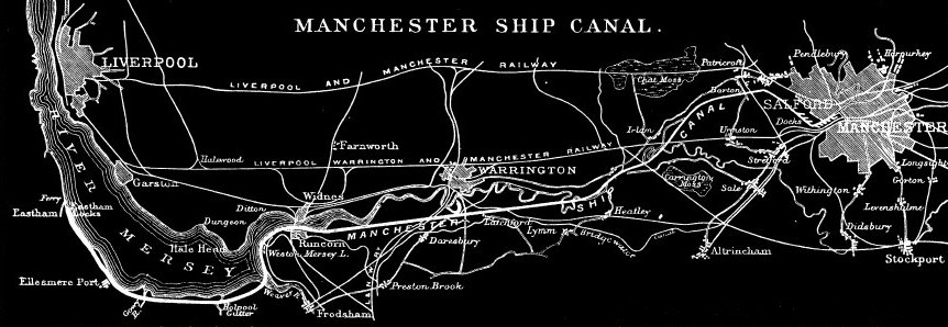
I am working on a page of scans of maps and plans of the the Manchester Ship Canal from Bosdin Leech's 1907 book.
posted by martin at 12:55 PM
0 comments
![]()


